quadjoin v. 0.6 by Frank Glandorf
Source and Linux/Windows XP (built with Cygwin) executables: sourceforge.net
8/6/2009 v 0.6 - Add support for geotiff
07/24/2007 v 0.5 - Add alpha channel for transparent backgrounds
07/07/2007 v 0.4 - bug fix for maps where collar is large compared to map scale
01/30/2007 v 0.3 - improve quadjoin clipping for scales 1:100k and 1:250k
12/13/2006 v 0.2 - quadjoin now works with scales 1:24K, 1:100k and 1:250k
A collection of command line tools to convert tiff and shapefiles originally designed to support the use of Arc Explorer (a free GIS viewer from ESRI) since it does no data conversions; and dlgvu (an SDTS viewer from University of Arizona).
- quadjoin
- Seamlessly join 1 or more USGS DRG (.tif) files using either geotiff or the accompanying world file (.tfw file) Any collars are clipped. Optionally make transparent background (warning this will increase file size). Note: the tiff files must have the same attributes, e.g. scale, color map, etc.
- shptoshp
- copy shape file to another and convert lat/long to utm (or any proj.4 projection) or with -i option utm to lat/long
- shptotxt
- convert shapefile to txt file (for dlgvu)
- drgshp
- draw shapefiles in a USGS DRG quadrangle tiff
To build the tools one must have:
| Proj.4 | version: proj-4.4.5 or better |
| libtiff | version: 3.5 or better |
| libgeotiff | version: 1.2.5 |
Assuming the above includes and libraries are in the usual place (/usr/include and /usr/lib) then build and install using:
        ./configure
	make
	make install
Note: The utility quadjoin was inspired by DRGTools drgjoin by Michael S. Warren, however quadjoin uses a different technique for joining files.
drgjoin had a couple drawbacks:
- drgjoin requires geotiff files. The geotiff tags are not always supplied with the tiff files and are non-trivial to create. Instead quadjoin uses either geotiff or world files (e.g. the accompanying .tfw file).
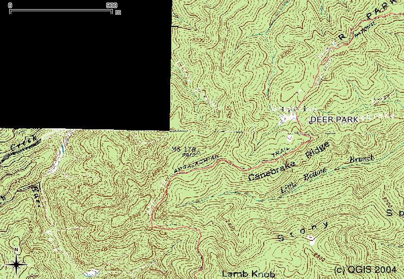
- drgjoin requires adjacent, pairwise north-south or east-west files. Instead quadjoin will accept any number of quadrangles in the same utm zone (or projection). This makes it convenient to create a single seamless tiff from a series of quadrangles which follow, for example, the appalachian trail.
Here's an example of quadjoin. This shows a section of the Appalachian Trail in North Carolina from Davenport Gap to Hot Springs. The image is scaled down since the actual .tif file is about 22 megabytes. The original map .tif files are from Coweeta LTER, French Broad GIS Collection. The trail and shelter data are from Appalachian Trail Conservancy. Data layers are displayed using Quantum Gis.

Closeup of seams